
Case study
Project Athena
A web map of the Afghanistan war, built for the people who served there and added to by them.
A war whose archive is still on people's hard drives
Afghanistan is not 1944. There is no fifty-year wait for the files to open, no reading room, no shelf of war diaries. The people who fought it are here, and a great deal of what survives from it is in their possession: photographs on old phones, on hard drives, in boxes.
The ground itself has gone unmapped in the same way. Combat outposts that existed for a few months, that a section lived in and named, do not appear on any published map. A veteran can tell you exactly where they were. There has been nowhere to point.
The people who were there are the record
For this war the usual order is reversed. The archive is not a collection waiting to be interpreted for the public — the public is the archive, and every year that passes without somewhere to put a photograph is material lost.
What that needs is a map accurate enough that a veteran recognises the ground, and a way for them to add to it directly.
What we built
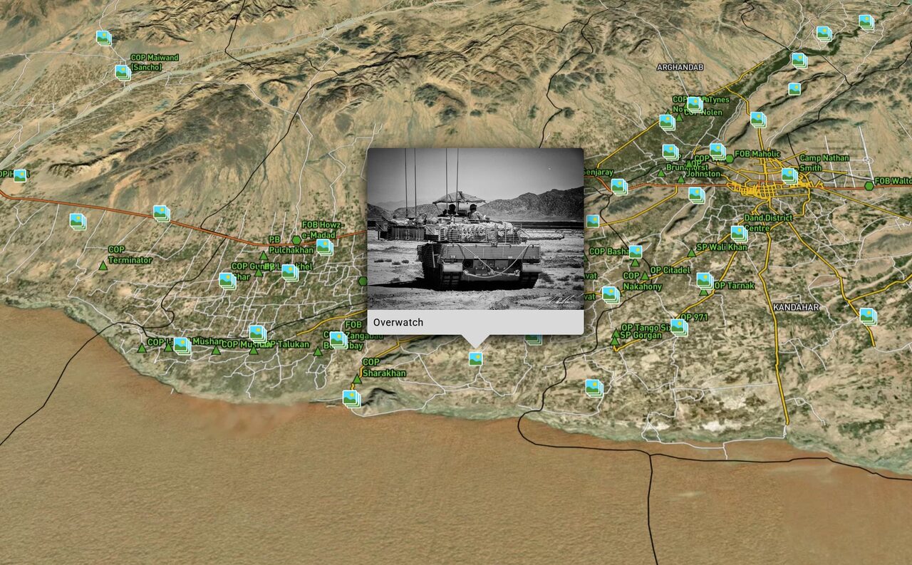
Project Athena runs on Frame 44 Atlas as a public web map of the Afghanistan war.
It holds the combat outposts, roughly 7,000 mapped IED strikes, and 1,900 geotagged photographs uploaded by the veterans who took them. A visitor can move across the country and see where things happened. A veteran can geotag their own photographs and put them on the ground where they were taken, which is how almost all of those 1,900 arrived.
The map has grown since November 2024 by the only means that works for a war this recent: the people who were there adding to it.
The moment it is built around
A veteran finds the outpost they lived in — not a town near it, the outpost — and adds a photograph of it. Their family can then see it too, in the place it happened rather than in a shoebox with nothing written on the back.
The specifications
| Deployment | Public web |
|---|---|
| Platform | Frame 44 Atlas |
| Mapped IED strikes | ~7,000 |
| Veteran-contributed photographs | 1,900 |
| Also mapped | Combat outposts |
| Contribution | Veteran upload with geotagging |
| Operated by | Canadian Research and Mapping Association |
| Live since | November 2024 |
| Views | 30,000 in the past year, growing |
| Website | projectathena.ca |
For museums with a modern conflict to tell
If your museum is commemorating Afghanistan and your material is photographs, personal accounts and places that never appeared on a map, that is the same problem. Tell us what you hold, and we will tell you what it looks like mapped.