Dieppe
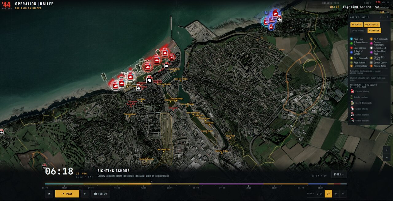
A guided map-story of the Dieppe Raid, researched and built, ready to publish.
Inquire
Catalogue
Licensable data, ready-made exhibits and cartography — browse what's available, then get in touch about your museum.
A finished, researched guided exhibit with its animated map — Studio 1 included, ready to publish in weeks.
A guided map-story of the Dieppe Raid, researched and built, ready to publish.
Inquire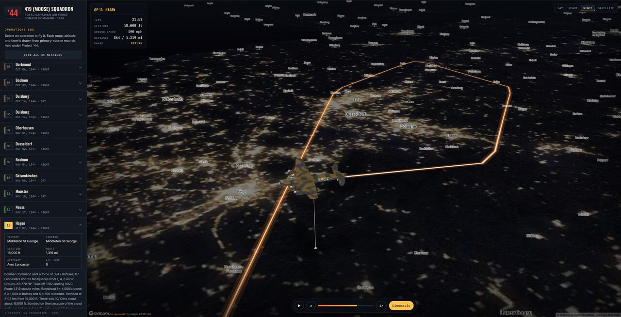
A guided map-story following 419 Squadron's operations, researched and built, ready to publish.
InquireNew exhibits added regularly.
Historical data licensed from Project '44, our Second World War mapping archive (CRMA), by scope — from one unit's full record to the complete WWII archive.
Follow one unit start to finish, every diary and movement.
1939–45 · Any regiment in the archive
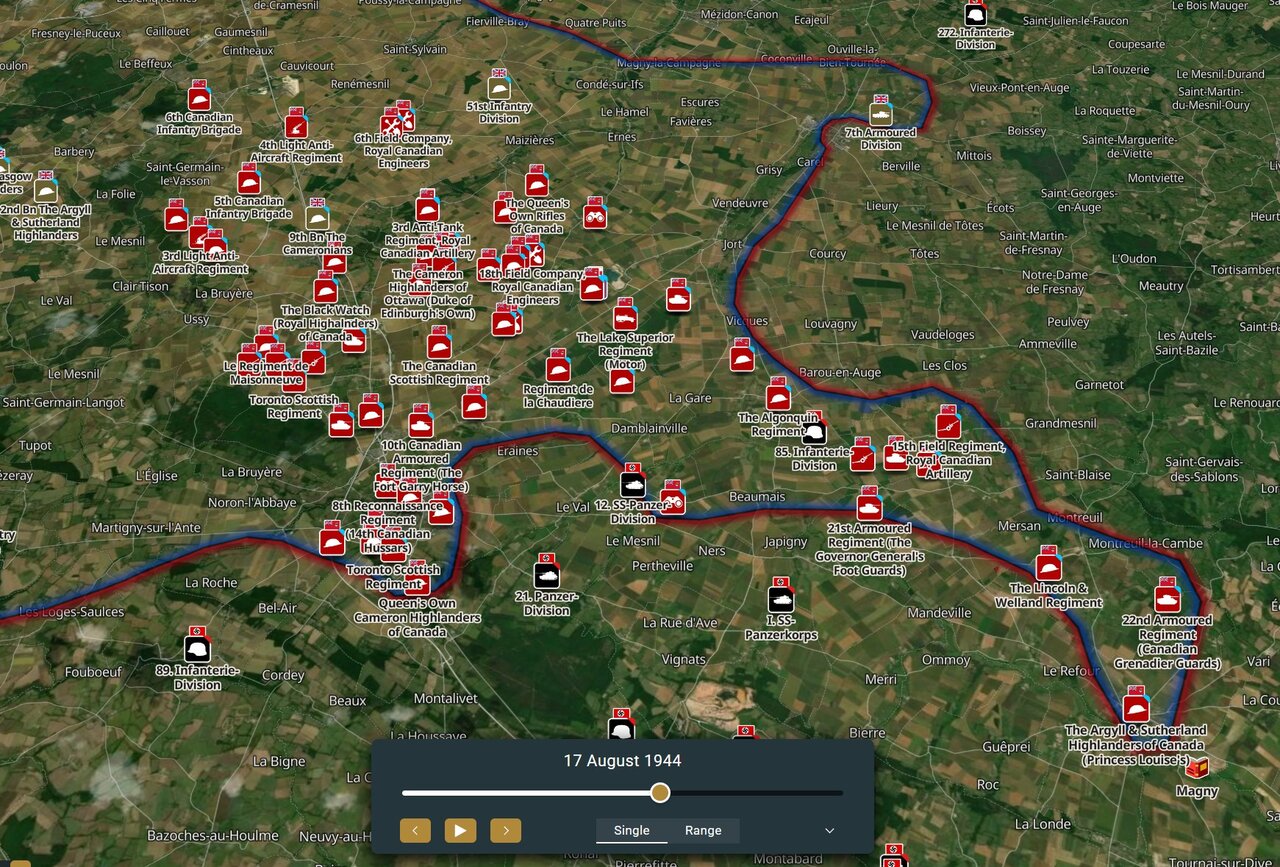
Follow one Canadian Army regiment start to finish — every diary entry and mapped movement, from any campaign the unit served in. A visitor can find their own regiment's badge on the map and trace its war from first action to last. We already have most Canadian Army regiments mapped — if yours isn't listed, ask and we'll check.
Inquire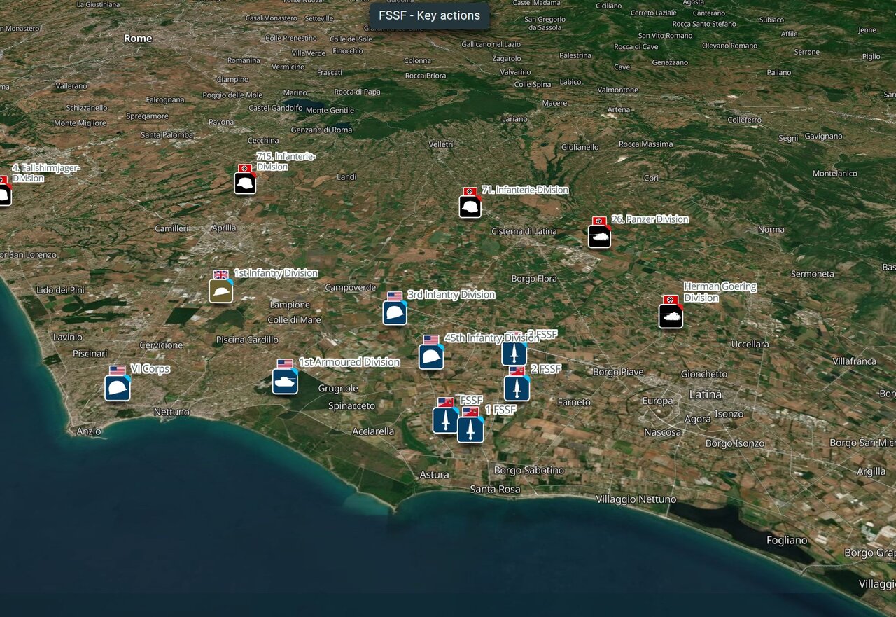
1942–44 · Aleutians to Italy
The Force's full war mapped position by position — from the Kiska landing to the Winter Line at Monte la Difensa, one continuous arc. A visitor can follow the Force day by day, Aleutians to Italy, without switching collections.
Inquire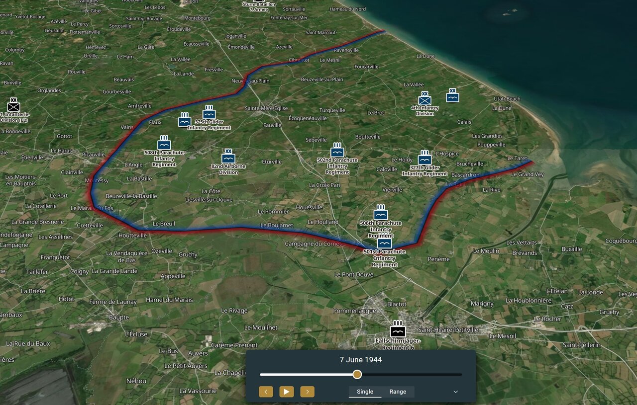
1944 · Normandy
The division's Normandy campaign mapped position by position, from the D-Day drop through the weeks of fighting that followed. A visitor can trace one division's war from a single jump into the dark to the campaign's close.
Inquire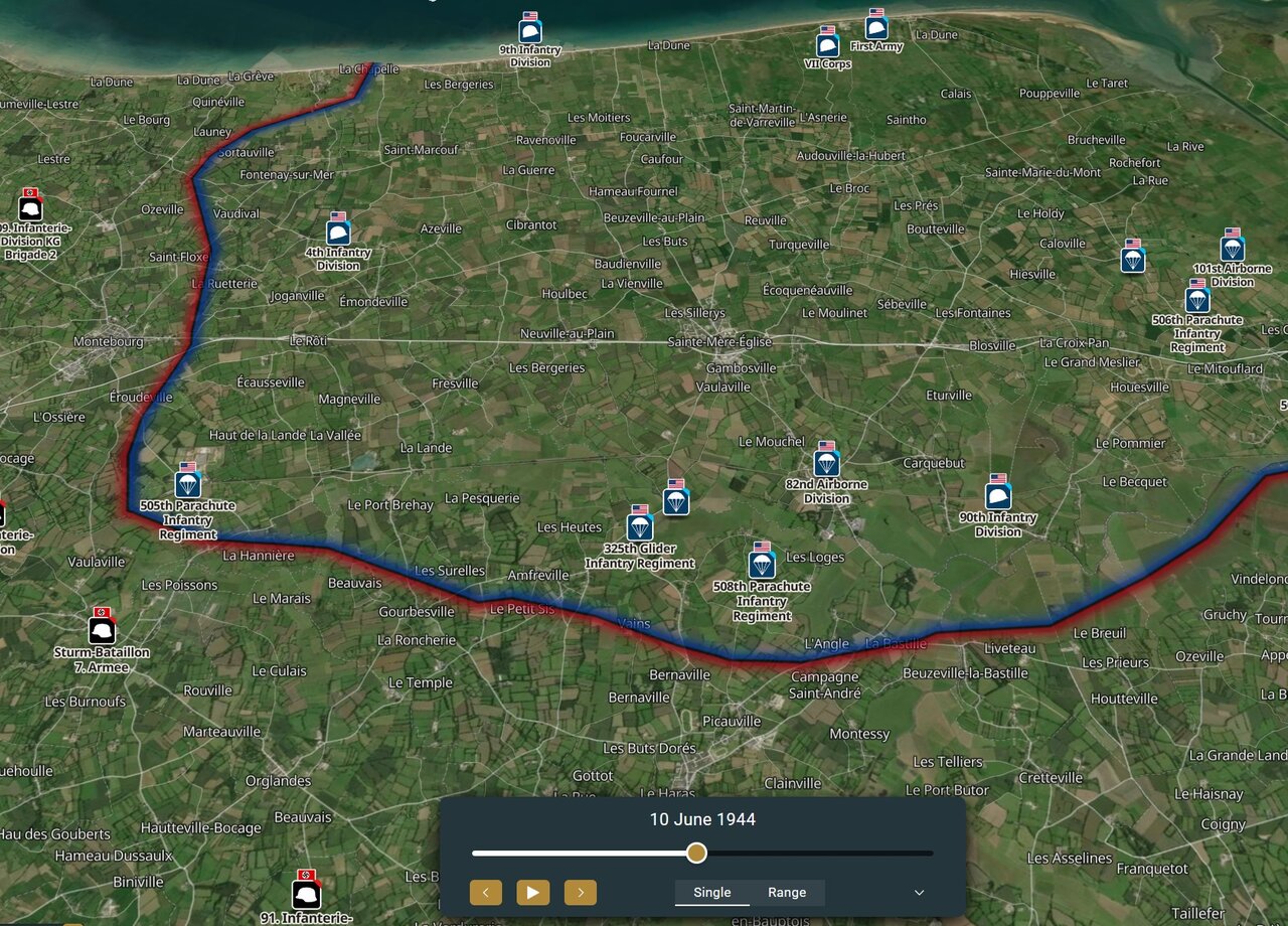
1944 · Normandy
The division's Normandy campaign mapped position by position, from the D-Day drop through the weeks of fighting that followed. A visitor can trace one division's war through the campaign without losing the thread.
Inquire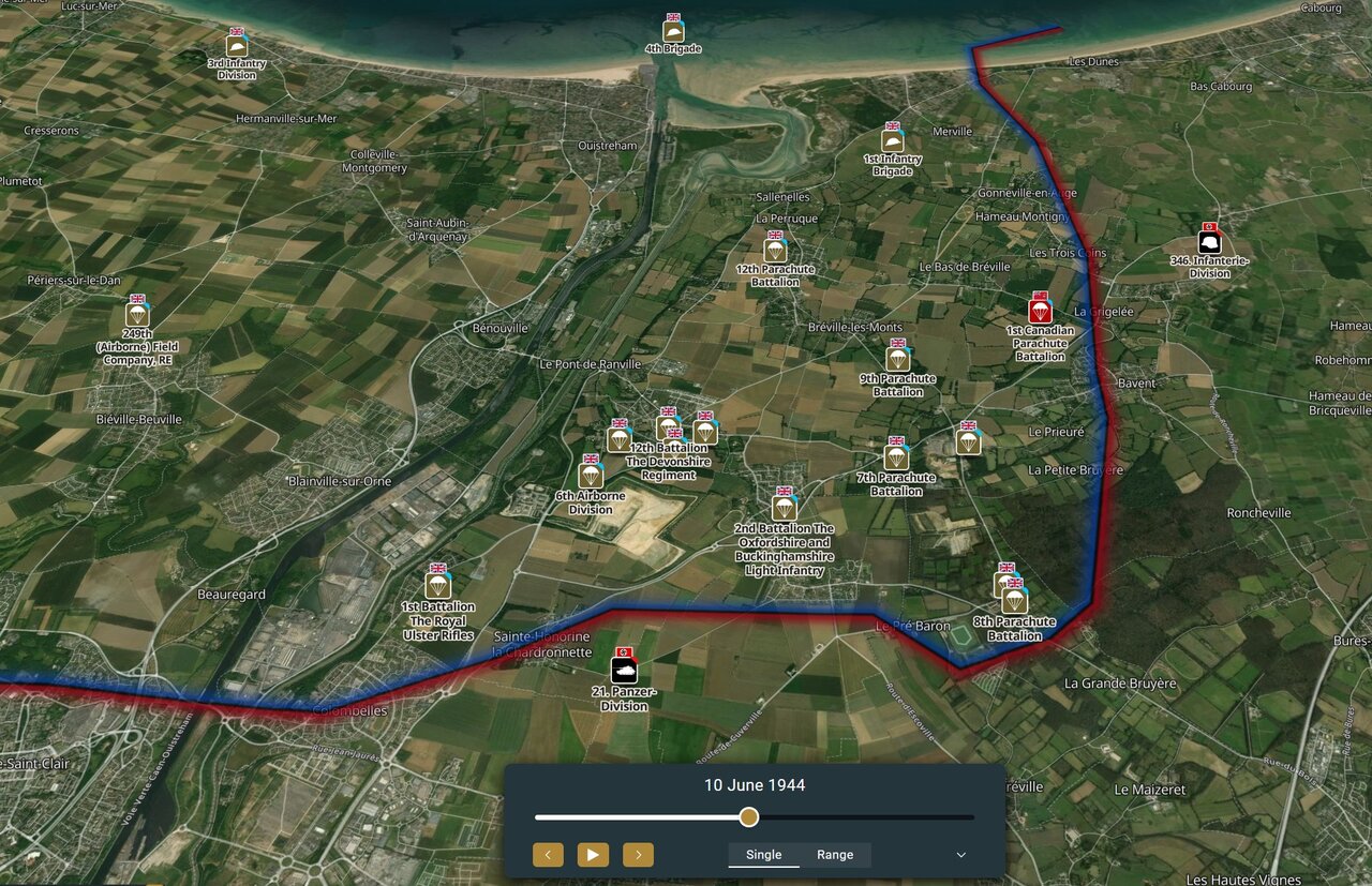
1944 · Normandy
The division's Normandy campaign mapped position by position, from the D-Day glider landings through the weeks of fighting that followed. A visitor can follow one division from the invasion's first hours through the campaign's close.
InquireEvery unit in one named battle or operation, both sides.
19 August 1942 · Dieppe, France
Every unit on both sides mapped through the Dieppe Raid — positions, movements and war diary entries for the whole day. A visitor can follow any single unit's landing, or watch the whole raid unfold across the beaches at once.
Inquire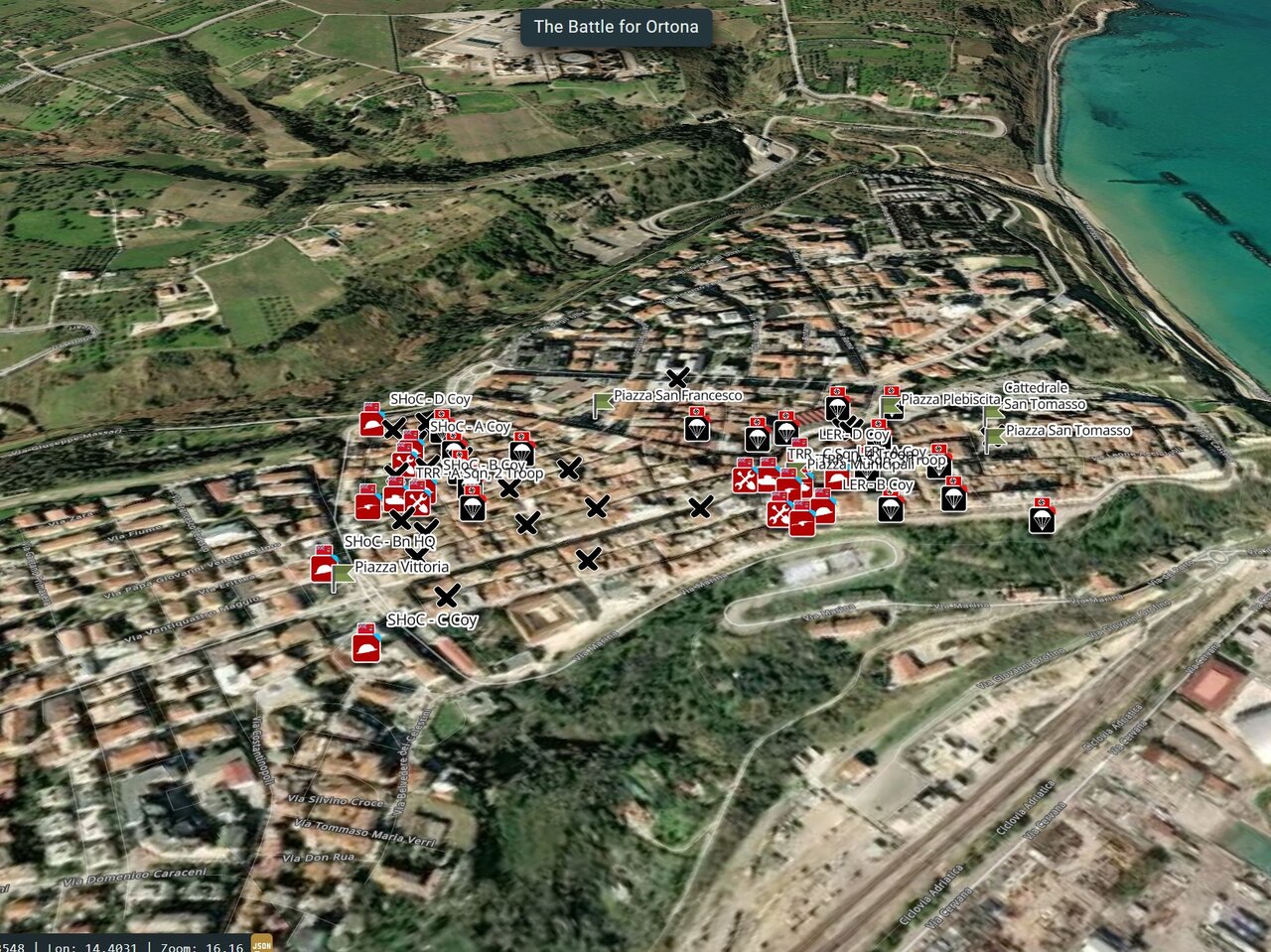
20–28 December 1943 · Ortona, Italy
Every unit on both sides mapped through the Battle of Ortona, the house-by-house fighting that closed out the Moro River campaign. A visitor can trace the advance street by street, day by day, from both sides of the line.
Inquire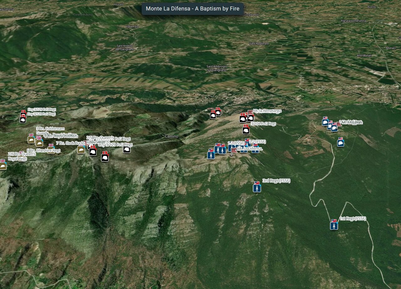
3 December 1943 · Camino Hills, Italy
Every unit on both sides mapped through the assault on Monte la Difensa, the First Special Service Force's first action in Italy. A visitor can follow the climb and the assault position by position, base to summit.
Inquire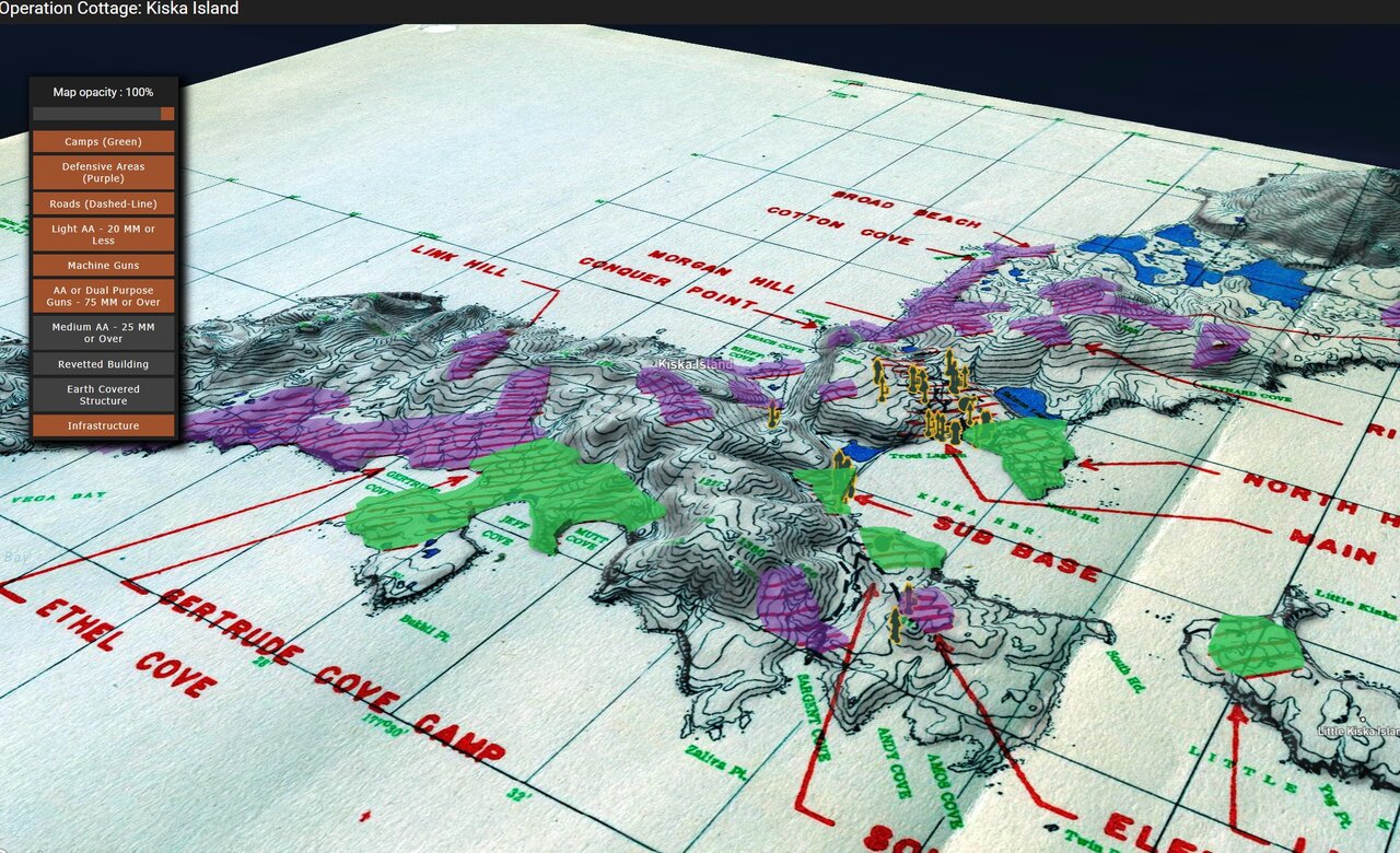
15 August 1943 · Kiska, Aleutian Islands
Every Allied unit mapped through the Kiska landing, the joint Canadian-American operation to retake the island. A visitor can follow the landing beach by beach, unit by unit.
Inquire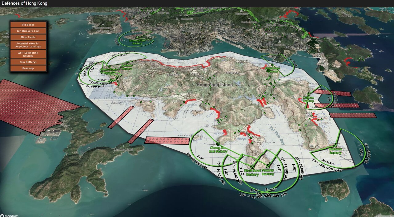
8–25 December 1941 · Hong Kong
Every unit on both sides mapped through the defence of Hong Kong, position by position across the eighteen-day battle. A visitor can follow the defence from the first crossing to the final surrender.
Inquire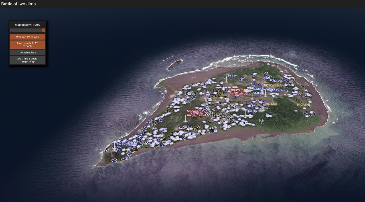
19 February – 26 March 1945 · Iwo Jima, Volcano Islands
Every unit mapped through the battle for Iwo Jima, position by position across the five-week campaign. A visitor can follow the advance beach by beach, ridge by ridge.
Inquire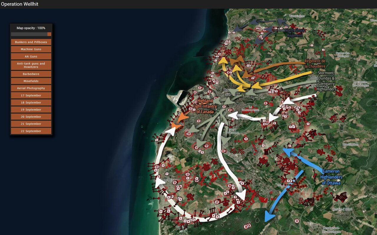
17 September 1944 · Boulogne, France
Every Allied unit mapped through Operation Wellhit, the First Canadian Army's assault to clear the Channel port of Boulogne. A visitor can follow the assault from the opening barrage to the port's fall.
Inquire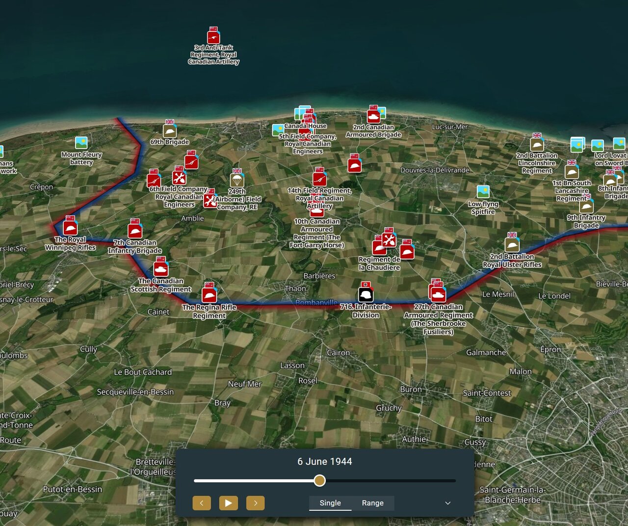
6 June 1944 · Normandy — 101st, 82nd and 6th Airborne
The airborne assault phase of D-Day, mapped drop by drop for the 101st, 82nd and 6th Airborne Divisions. A visitor can follow each division's drop zone and first hours on the ground, side by side.
InquireEvery unit across an entire theatre.
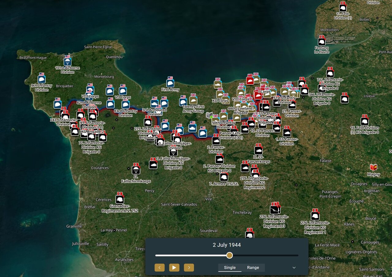
6 June – 25 August 1944 · Normandy, France
Every unit mapped across the Normandy campaign, from the landings to the closing of the Falaise pocket. A visitor can follow any unit, any division, across the full eleven-week campaign.
Inquire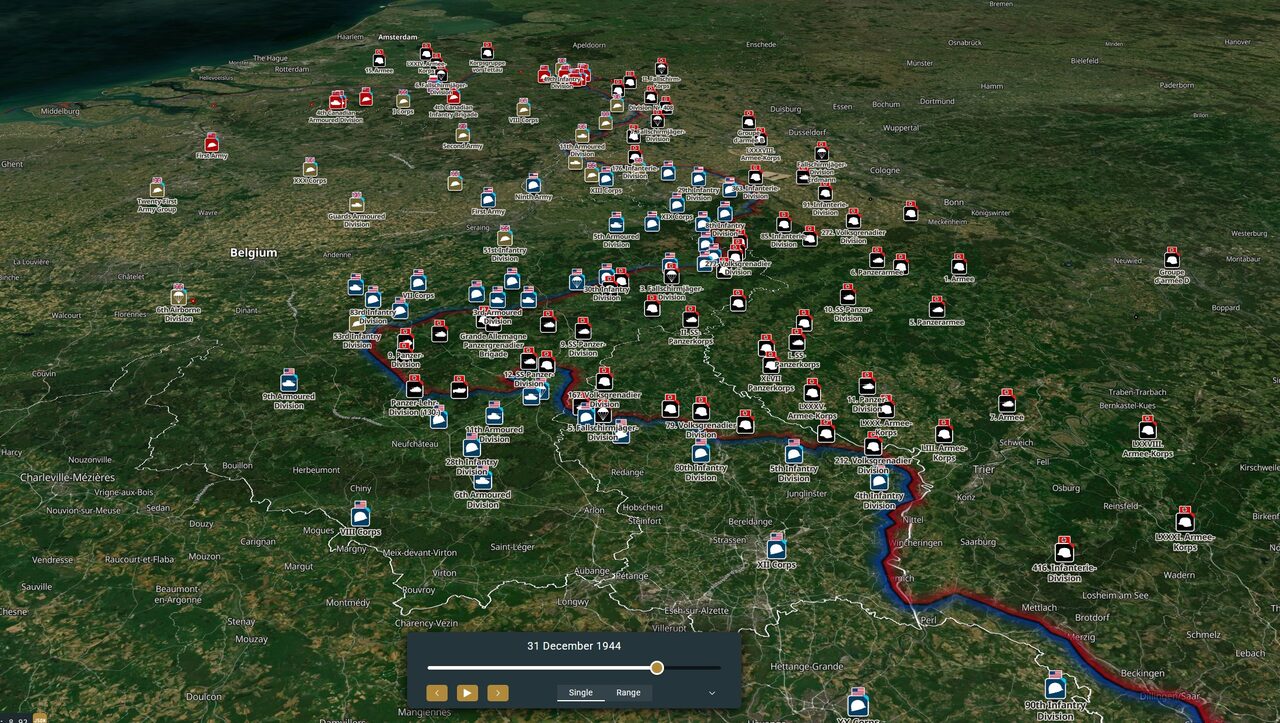
1944–45 · Belgium, the Netherlands, Germany
Every unit mapped across the liberation of Belgium and the Netherlands and the advance into Germany. A visitor can follow the campaign town by town, from the Scheldt to the Rhine.
Inquire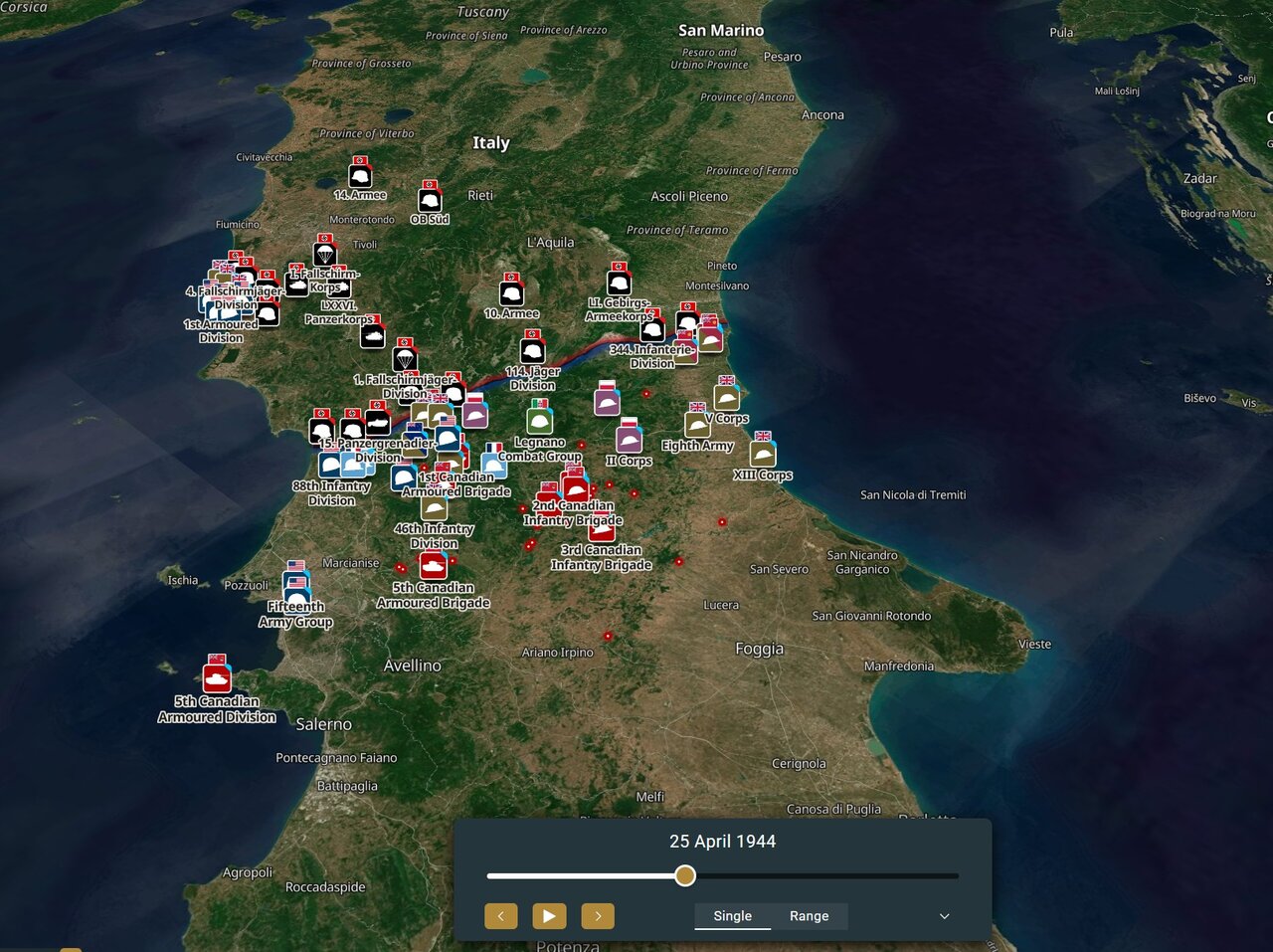
1943–45 · Sicily to the Po Valley
Every unit mapped through the Italian campaign, from the Sicily landings to the advance into the Po Valley. A visitor can follow the campaign river line by river line, from Sicily to the Alps.
InquireSites and dates plotted by theme — mapped locations, not full diary records.
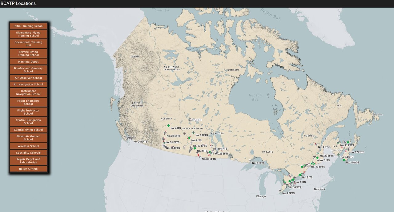
1939–45 · Air training stations, Canada-wide
The British Commonwealth Air Training Plan's stations and schools, mapped across the country. A visitor can find their own community's station on the map.
Inquire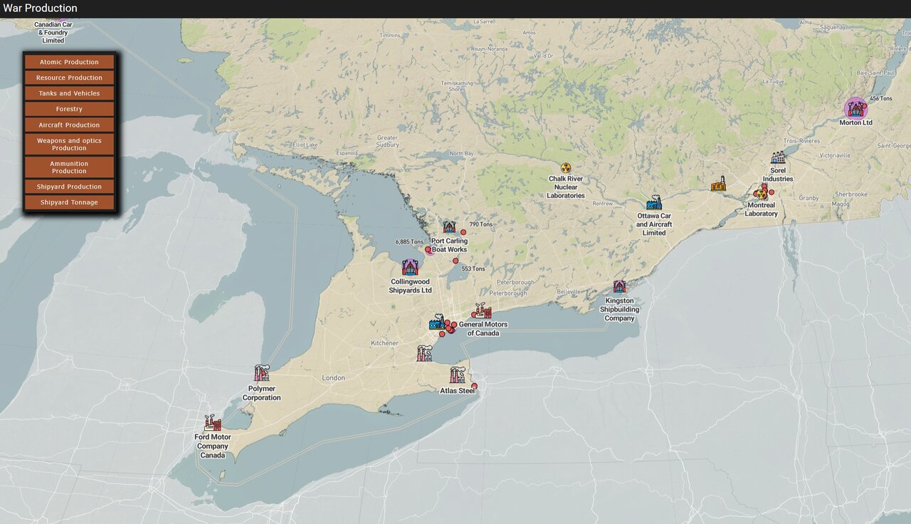
1939–45 · Canadian wartime industry
Wartime factories, shipyards and munitions works mapped by site, with what each one built. A visitor can find their own town's plant and see it in the context of the wider war effort.
Inquire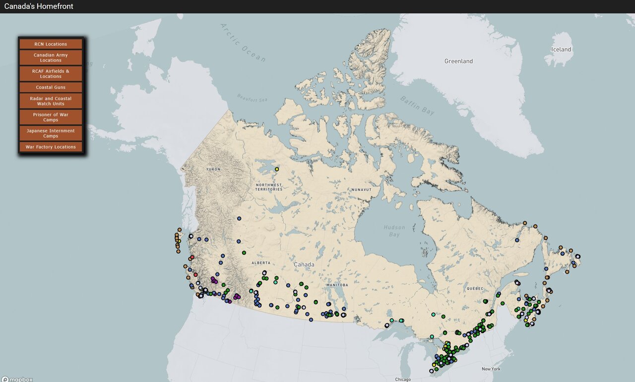
1939–45 · Canada
Rationing, victory bonds, civil defence and the daily life of the home front, mapped by community. A visitor can see their own community's wartime record alongside the rest of the country's.
Inquire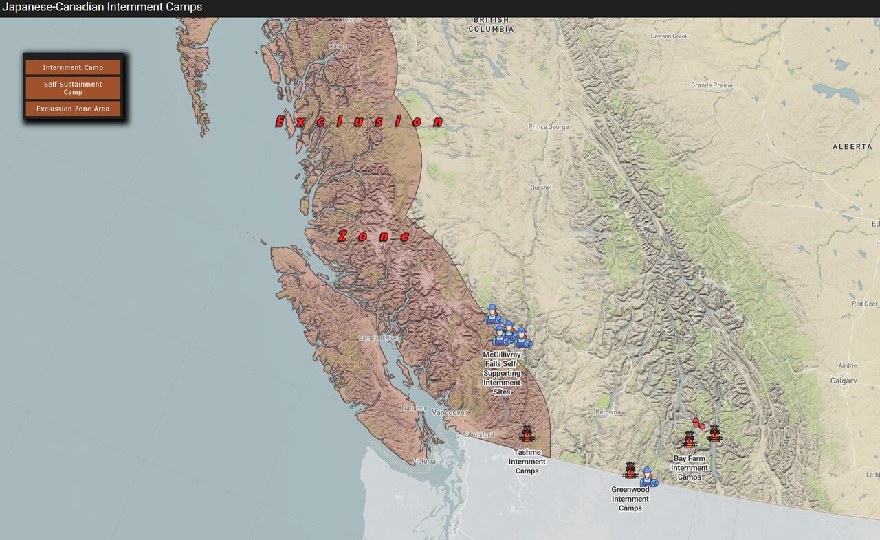
1942–49 · British Columbia and interior Canada
Internment camps, road camps and dispersal sites mapped by location and period. Records the location and timeline of internment and dispersal, not a curated narrative.
Inquire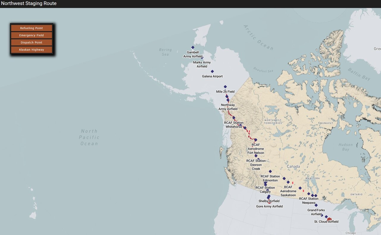
1941–45 · Alberta to Alaska
The airfield chain built to ferry aircraft from Alberta to Alaska, mapped strip by strip. A visitor can follow the route field by field, Edmonton to Fairbanks.
Inquire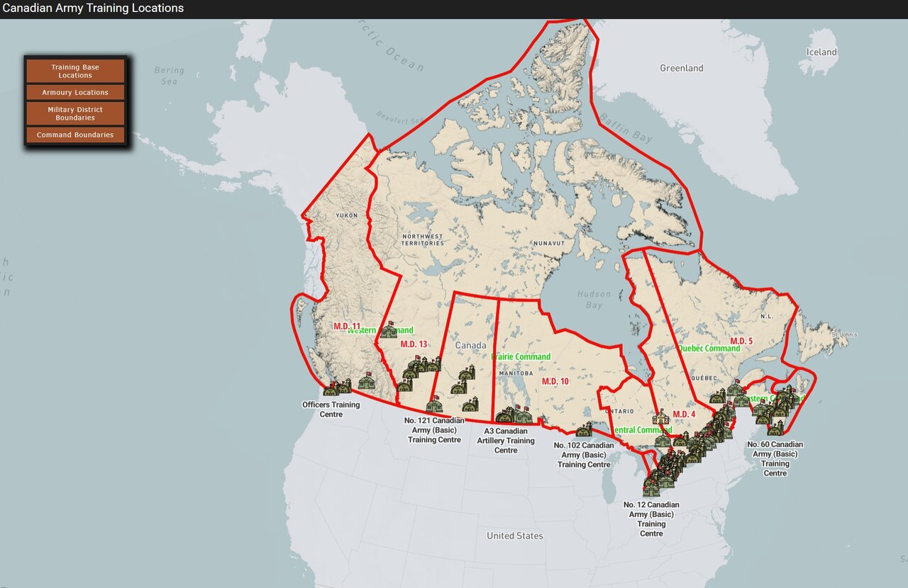
1939–45 · Training camps, Canada-wide
Army training camps and ranges mapped by location, with the units that trained there. A visitor can find their own community's camp and see which units passed through.
Inquire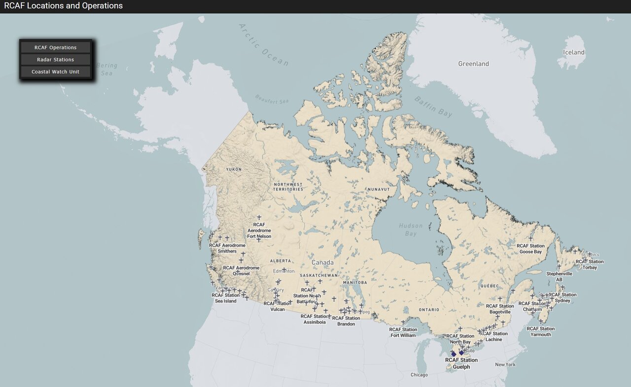
1939–45 · Canadian coastal and home defence
RCAF home-defence squadrons and stations mapped by posting, guarding Canada's coasts and cities. A visitor can find their own region's squadron and its patrol area.
Inquire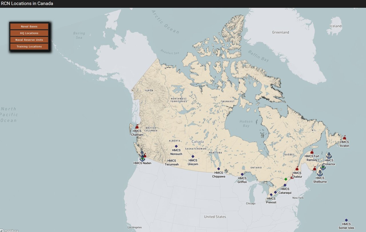
1939–45 · Atlantic and Pacific coasts
Coastal batteries, harbour defences and naval stations mapped along both coasts. A visitor can find their own harbour's defences and see how they fit the wider coastal system.
Inquire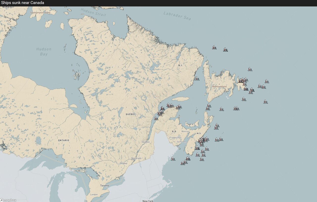
1942–44 · Gulf of St. Lawrence and Atlantic Canada
Merchant and naval vessels sunk in the Gulf of St. Lawrence and off Canada's Atlantic coast, mapped by location and date. A visitor can find the wreck closest to their own shoreline and see when it went down.
InquireEverything — every theatre, unit and diary — as the archive grows.
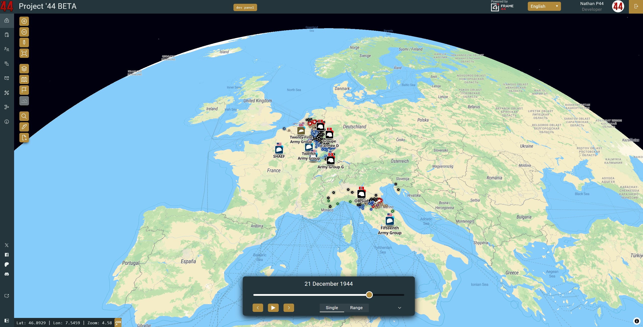
Every theatre, unit and diary
The full Project '44 WWII dataset, as it grows. A visitor, or a researcher, can move between any theatre, unit or diary without switching collections.
InquireLicensing more than one collection — your most expensive licence is full price, every additional licence is half off, and you'll never pay more than the Complete Archive.
Unit not in the archive yet? We'll research, map and digitize it, priced per diary month of active service with archive retrieval at cost, estimated upfront. Your unit joins the open Project '44 archive with your museum credited as founding partner, and the first year's Unit Collection licence is included. Need the data kept private? Closed licences are available at a multiple of the open rate.
Perpetual licences are available for offline and secure installations — ask us.
Additional licensed archives, outside the five collection tiers above.
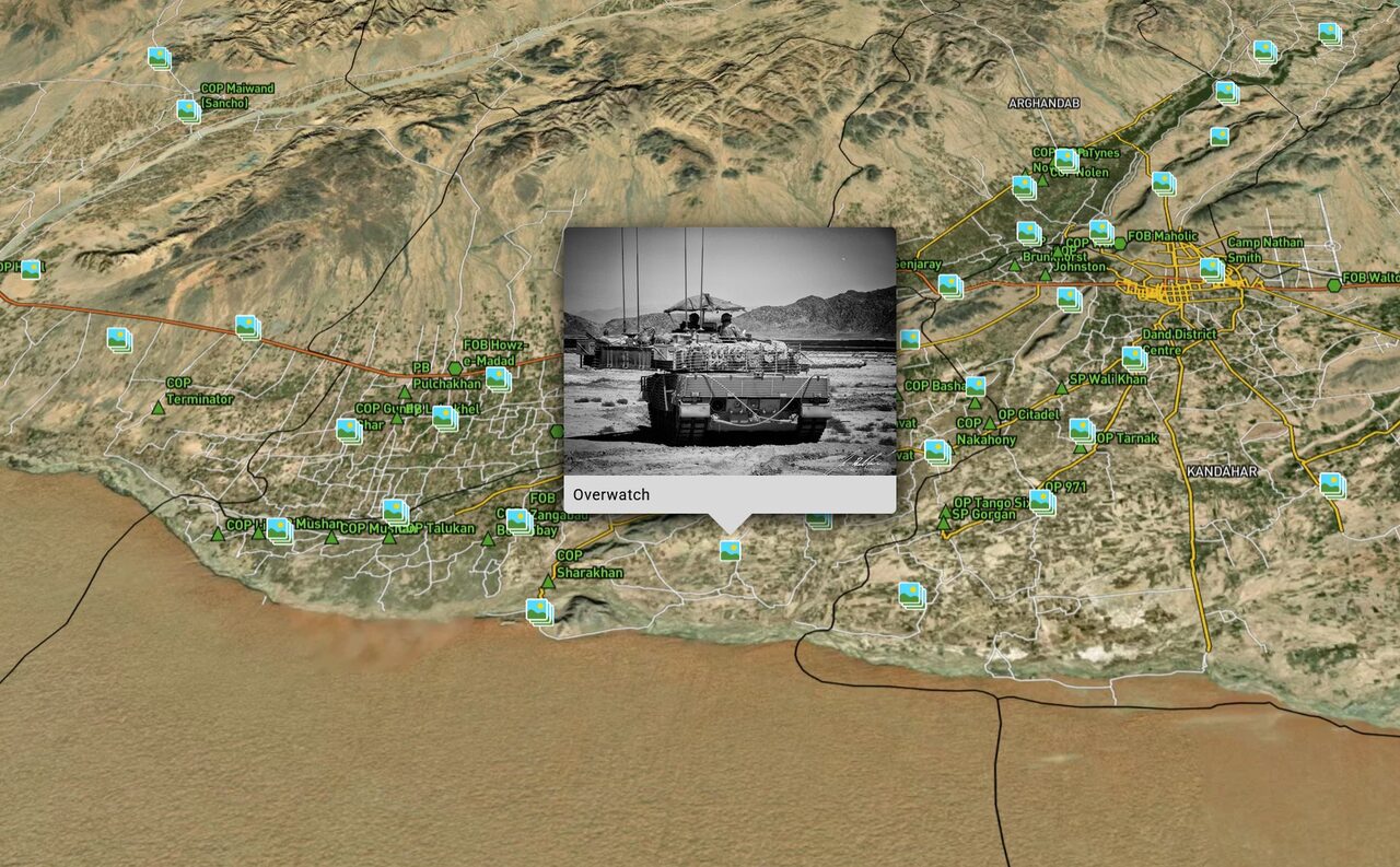
Project Athena
Veteran-contributed, geotagged photos of your regiment's tours, mapped to where they were taken. A visitor can follow one tour, posting by posting, through the photos the veterans themselves contributed.
Inquire
Project Friction
A complete, sourced dataset covering the Gulf War, mapped and museum-ready. Built by our research partners rather than Project '44 itself.
InquireHistorical basemaps, period aerial imagery, and site layers mapped through time.
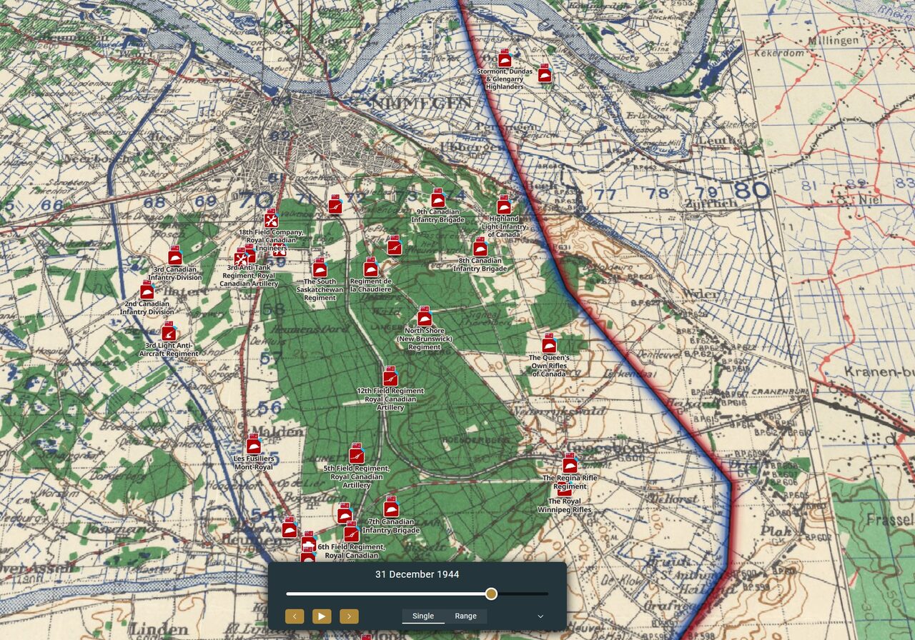
GSGS series maps, army-group situation maps, and period-accurate projections, ready to layer under your exhibit.
Inquire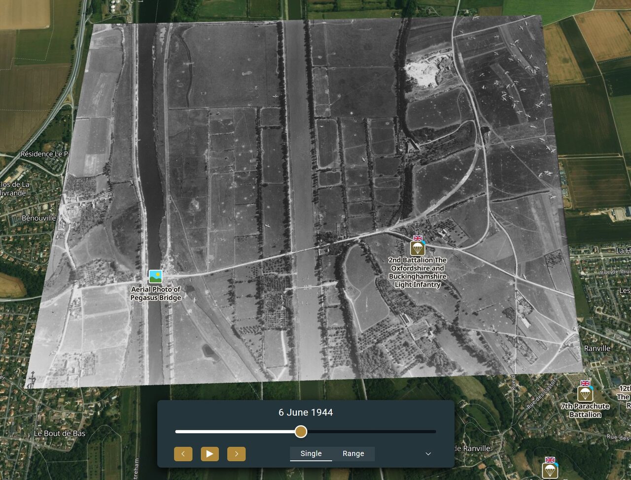
Wartime and immediate post-war aerial photography, geo-referenced for use as a map layer.
Inquire
A site mapped through time — historical layers of a single location across different periods.
InquireTell us a little about your museum and what caught your eye — we'll follow up with pricing and next steps.
Thank you — your message is with us.
We read every inquiry ourselves and reply within two business days.
Prefer email? Write to us at info@frame44.com
The archive already covers homefront, industry, aviation infrastructure and maritime defence alongside combat — the whole war, not just the fighting. If your unit or subject isn't here yet, we can likely add it.