
Case study
Project '44
The largest mapped record of the Northwest Europe campaign, running in public on Frame 44 Atlas.
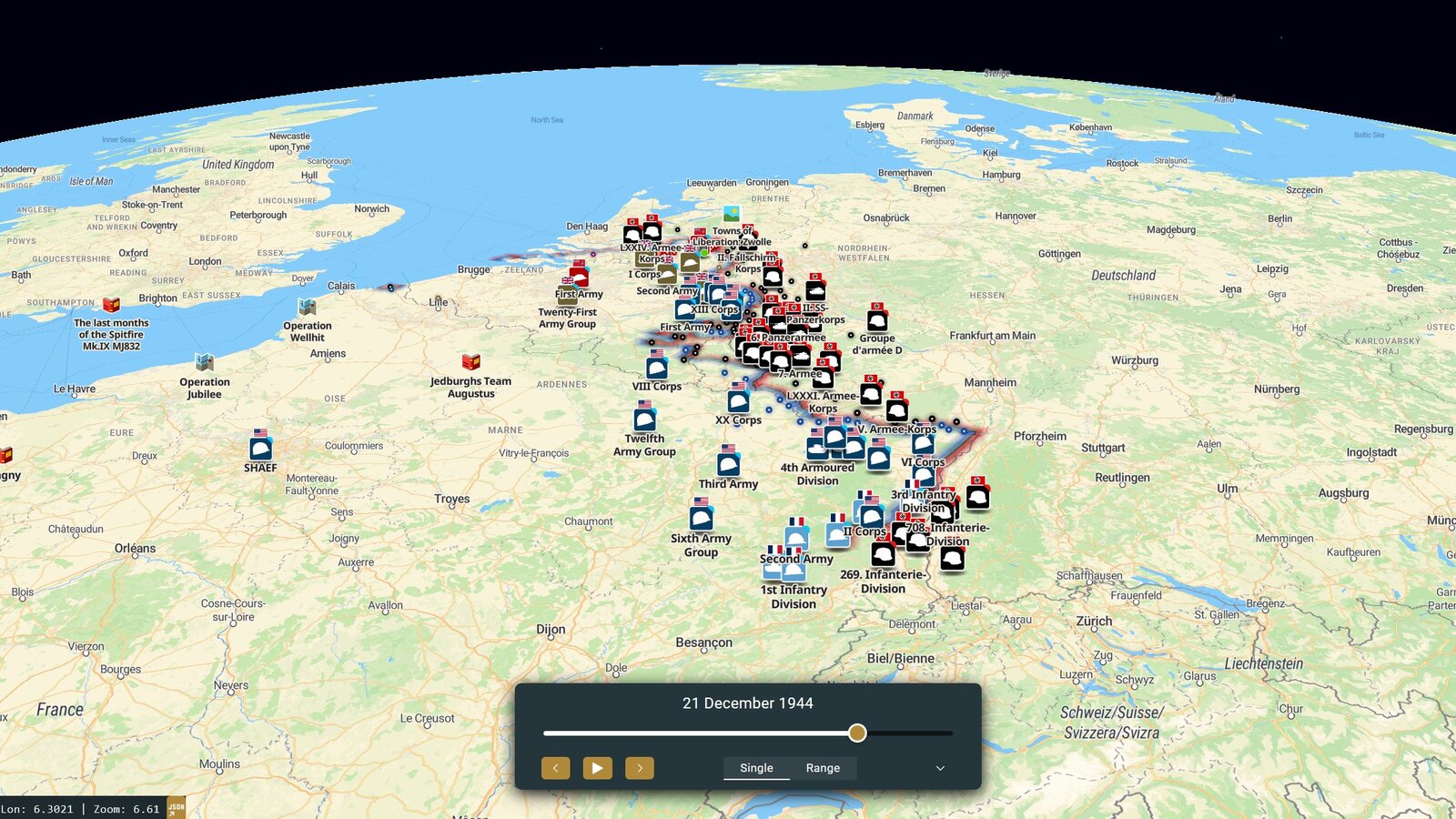
Eight years, four national archives
The Northwest Europe campaign is one of the best documented events in modern history and one of the hardest to see. The unit records sit in Ottawa, Kew, Freiburg and College Park. Reading them means knowing which fonds to ask for, how a war diary is structured, and how to turn a wartime grid reference into a place on a modern map. That last step alone stops most people, and it has to be done for every entry.
Project '44 has been doing it for eight years. 160,000+ mapped unit positions, Allied and German, drawn from more than 15,000 pages of war diaries held by Library and Archives Canada, The National Archives, the Bundesarchiv-Militärarchiv and the US National Archives.
The problem that comes with an archive that size
A spreadsheet of 160,000 positions helps nobody. The record only becomes useful when a person can ask it an ordinary question — what happened in my town, where was my grandfather's regiment, which unit was here on this date — and get an answer without knowing anything about archival referencing.
That is a mapping problem and an interface problem before it is a history problem.
What we built
Project '44 runs on Frame 44 Atlas as a public web deployment, free to use in a browser.
The map holds every mapped position, dated. Search works the way a visitor thinks rather than the way an archive is catalogued: what, where, when. Selecting a unit opens the war diary entries behind its positions, so the source sits next to the claim instead of in a footnote. Guided map-stories sit on top of the same data for people who would rather be led than search — the 419 Squadron RCAF story runs 31 bombing operations as an animated flight path, one raid at a time.
It is the same platform the museum installations run on. Project '44 is where it is proven at scale, in public, under real traffic.
The visitor moment
Someone sits down with a regiment name off a discharge paper and types it in. They get positions, dates, and the unit's own words for the week their grandfather was there. No archive request, no reading room, no grid conversion, no knowing what a fonds is.
The audience that came with it
Project '44 has been public since 2019 and has built a following of more than 40,000 people who care about this history specifically. That matters to a museum for a practical reason: an exhibit built from this record does not launch into silence. When an installation opens, there is an audience already assembled that wants to hear about it.
The specifications
| Deployment | Public web, desktop browser |
|---|---|
| Platform | Frame 44 Atlas |
| Mapped positions | 160,000+, Allied and German |
| War diary pages | 15,000+ |
| Sources | Library and Archives Canada, The National Archives (UK), Bundesarchiv-Militärarchiv, US National Archives |
| Institutional partners | LAC, Veterans Affairs Canada, IGN, Dutch heritage museums |
| Live since | 2019 |
| Page views | 500,000 a year on project44.ca |
| Following | More than 40,000 |
| Website | project44.ca |
How this connects to Frame 44
Project '44 is run by the Canadian Research and Mapping Association, a Canadian nonprofit that shares a founder with Frame 44. CRMA runs its public map on Atlas. Frame 44 licenses CRMA's research under agreement and builds museum exhibits from it.
That's why a small museum can open an exhibit built on 100,000+ mapped positions without funding a research programme of its own — the research already exists, ready to build from.
Every installation starts with a conversation.
We'll scope your exhibit and price it to your funding — no obligation.